GUEST BLOG | 5 MIN READ
Microsoft Dynamics 365 Territory Management with Maplytics
Learn how Maplytics can transform your territory management capabilities.

Sales teams on the go rely on technology to keep their data organized and up to date. If your team already uses Microsoft Dynamics 365 Sales or Marketing, an integration with Maplytics can streamline travel routes and improve data flow and collaboration.
This article is a guest post by the creators of Maplytics, an integrative solution that connects Bing Maps and Microsoft Dynamics 365 CRM. Read on to learn about the many features available in Maplytics.
Businesses looking to mitigate lost sales leads need an all-inclusive package that integrates with Dynamics 365 CRM and virtually defines sales territories on maps. Maplytics is a preferred, 5-star-rated geo-analytical mapping app on Microsoft AppSource for Microsoft Dynamics 365 CRM that satisfies this need.
What Is Maplytics?
Built by Inogic, a leading Independent Software Vendor (ISV), Maplytics seamlessly integrates Bing Maps with Dynamics 365 CRM. This integration provides users across industries with a visual representation of geo-coded data and tools to create optimized routes, automatically schedule appointments, conduct a Radius Search for nearby clients, define sales territories, and more.
Maplytics elevates overall business productivity by streamlining day-to-day business operations. Plotting optimized routes to clients is easy and the routes can be viewed and traced in real-time over maps. This visual representation of client geographies plays a major role in territory management for sales and marketing teams using Microsoft Dynamics 365 CRM.
Territory Management
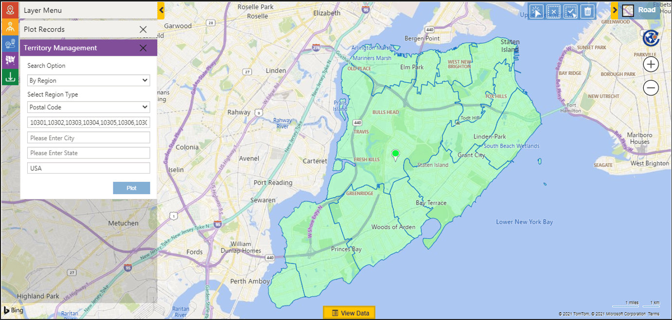
How do I create territories?
Maplytics lets users demarcate territories based on counties, postal codes, cities, states, and other landmarks. Users can even draw territories freehand, which allows regions to stretch across city and state boundaries. The auto territory tool helps users evenly divide clients or the leads among sales reps.
How can I define territories?
Maplytics defines map territories in many ways, including by:
- City
- County
- State
- Country
- Postal Code
- Postal Code Sector
- Postal Code (Outward)
- Postal Code Area
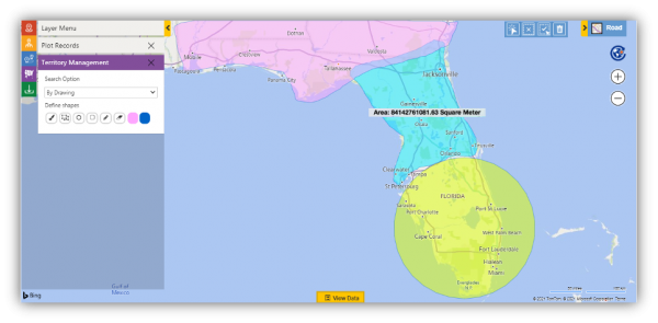
How do I draw territories?
Using the drawing tools, geometric, freehand shapes can be drawn over the maps to define unique territories that can go beyond the boundaries of cities and postal codes.
How do I automatically create territories?
Territories can also be created automatically using the shape and Excel files and the count of the records plotted. This generates the desired number of balanced territories. This can be done using the ‘By File’ option to upload a shape or Excel file to plot it on the map. Users can also choose the ‘By Overlay’ option to plot a file that contains census data on the map.
To plot the census data, users can choose the ‘Files’ option under Overlay. Users can also choose categories and summary attributes to color code the regions.
Users can create multiple territories in one region. After plotting locations, users can select how many new territories they’d like to create based on those records. Managers can also move and copy regions between territories, which gives every stakeholder the chance to adjust territories based on incoming data.
When Microsoft Dynamics 365 and Maplytics connect, reps can view their assigned territories and relevant leads in one easy-to-navigate window.
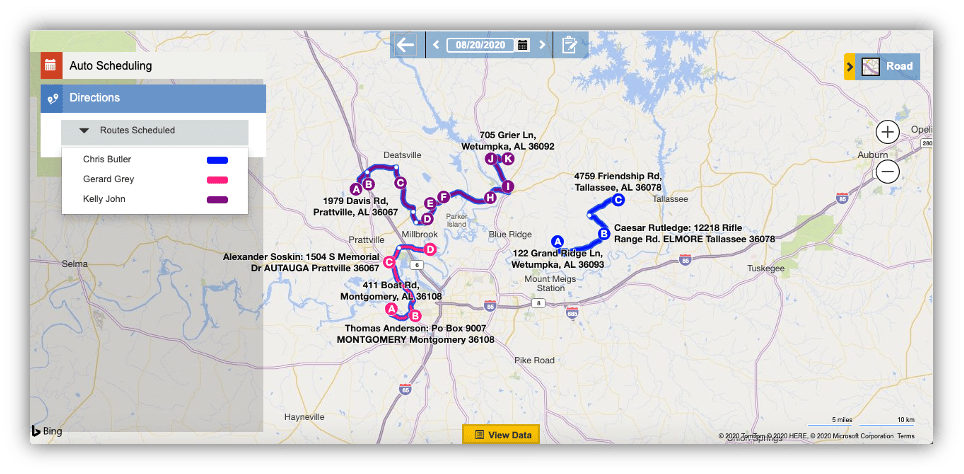
Route Optimization
How do I optimize routes?
Maplytics lets users select their current location and destination, and the software plots the most optimized route between them based on congestion, tolls, highways, and travel time. Turn-by-turn navigation offers additional help.
Route optimization not only aids in plotting routes, but also allows these routes to be saved, modified, shared, and printed for reference.
If appointments are cancelled or postponed, sales reps can update their routes accordingly. Alternatively, unexpected meetings can be added to routes.
Several other features help sales reps optimize their routes:
- Along the Route – Search for and add new stops to their routes.
- Proximity Search – Find relevant locations and records within a specified radius of your current location.
- Auto Scheduling – Generate an optimized list of route assignments based on sales rep availability.
Maplytics is one of the most popular productivity apps available from Inogic, and for good reason—its territory management and route optimization features are second to none. By connecting Maplytics and Dynamics 365 CRM, businesses can manage territories with ease. Sales reps can keep leads organized, and stakeholders across the business can access up-to-the-minute data whenever they want and wherever they are. For more information on how combining Maplytics with Microsoft Dynamics 365 CRM can boost your business, connect with Cargas.

Let’s Chat
Before investing in new software, speak to a Cargas team member.